The 2024 UK General Election happens on July 4th. This election will be fought on a new set of constituency boundaries, with the makeup of constituencies changing for the first time since 2010. You can find out more information about these changes on the parliament.uk website.
If you're analysing or visualising data by parliamentary constituency, then you probably want to use the new 2024 boundaries. I thought it might be useful to show how to get data on these new boundaries, particularly as lots of the main sources of boundary data haven't yet updated to take them into account.
Source data
The source I tend to use for boundaries is the ONS Geoportal. They've produced a category bringing together all the data on the new constituencies. Some of the useful files are:
- List of the names and codes of the new constituencies
- Boundary data can be downloaded as GeoJSON or in other formats at a variety of resolutions (the higher resolution files are larger): Highest resolution 1, Highest resolution 2, Lower resolution and lowest resolution.
- Postcode lookup - mapping every UK postcode to the new constituencies
- Lookups from old constituencies to new ones - note that these aren't one-to-one, so where it'll show two constituencies that overlap to form a new one
- Lookups from smaller geographies to the new consitutencies: Output Area 2021, Output Area 2011, LSOA 2021, MSOA 2021, Ward - note that these lookups are generally done through a "best fit" method, because the areas don't match exactly.
Find that Postcode
I've updated the Find that Postcode tool to use parliamentary constituencies as the default. Here's an example constituency.
In particular, you can use the Add fields to CSV tool if you have a list of postcodes in CSV format, to add data about parliamentary constituencies (or other areas) to that list.
Other resources
- Open Innovations have created a hex map layout for the new constituencies.
- Open Innovations have also then used this to create a resource of maps using the new constituency data.
- MySociety have a data resource with data on the new files
- Alasdair Rae and Philip Brown have also produced a hex map along with some nifty 3-letter codes
- The House of Commons library has some data plus links to other resources
- Ordnance Survey have also released boundary data
- For more politics-focused data, the Institute for Government have some data on the implications of the boundary changes.
This map shows an example of a boundary change, produced by the House of Commons Library
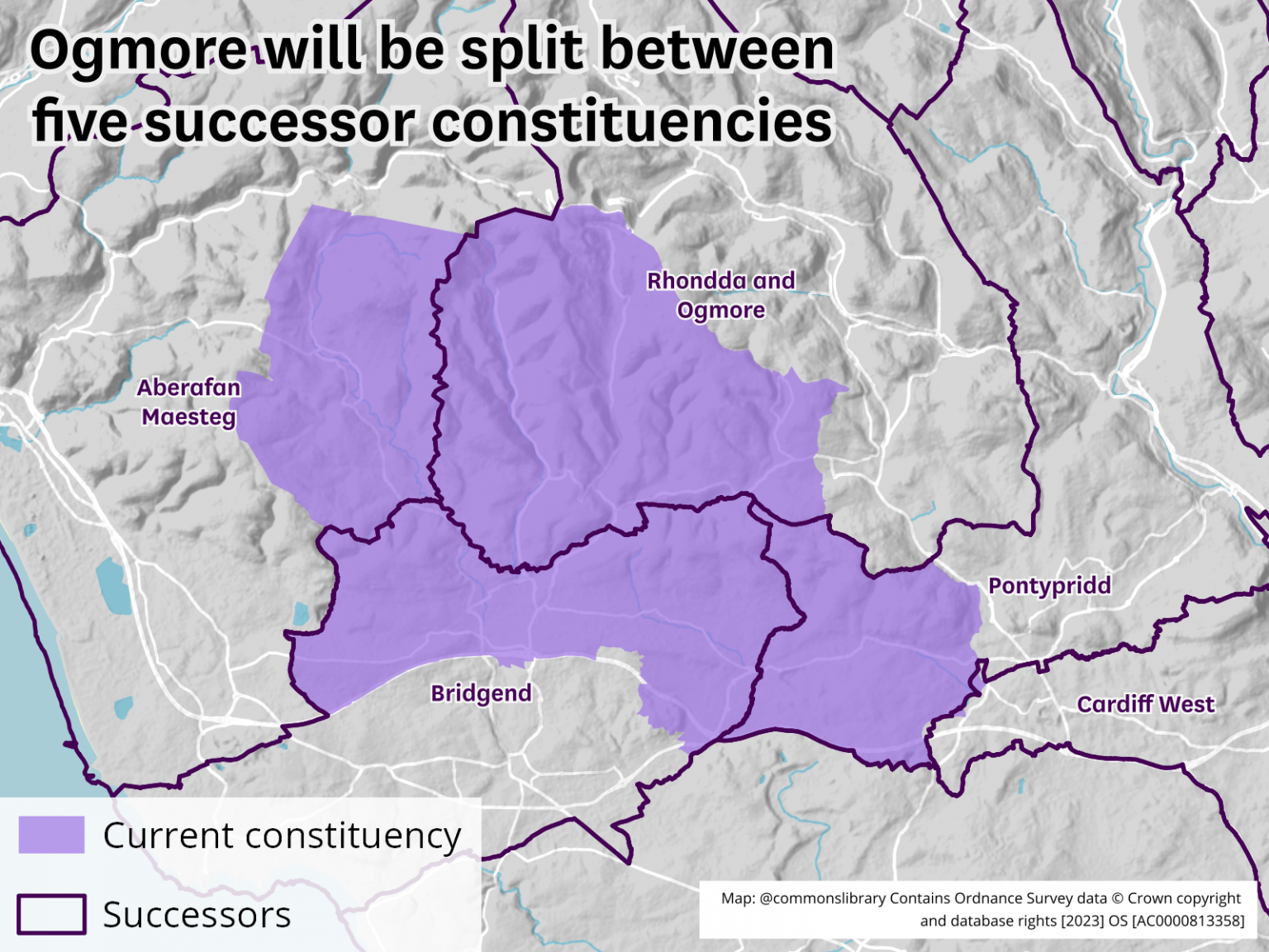
Source: House of Commons Library
