Geographic boundary data is a requirement for any geographic analysis or map-making. But finding boundary data is often a nightmare.


Just Googled for "UK county boundaries as GeoJSON". Results:
1. data.gov.uk no joy (see screenshot).
2. gis.stackexchange.com post from 2015, suggesting I use ogr2ogr...
3. A site that has data, unfortunately it's not UK counties or #geojson.
#opendata #toohard pic.x.com/bi5gvhd61d

This is a problem I've faced too, so I thought it might be useful to outline some of the places to look for boundary data:
ONS Open Geography Portal
This site - which leaves a lot to be desired in terms of usability & reliability1 - is the main place the ONS shares their boundary data. What it lacks in user experience it makes up for in breadth and depth - there are a range of boundaries across lots of different types of area, and with a variety of different variations to download.
For a given boundary, there are usually four or five different versions with different resolution. The lower resolution files are generally smaller, but will produce simplified versions of the boundaries rather than the exact boundaries. The more generalised versions are better for things like chloropleth maps where you're comparing lots of different areas, and don't need the boundaries to be exactly right. The exact versions are better for when you show just one area in a lot of detail.
The different versions included are:
- Full resolution - extent of the realm
- Full resolution - clipped to the coastline
- Generalised (20m)
- Super generalised (200m)
- Ultra generalised (500m)
The "extent of the realm" files include some offshore islands and use the mean low water mark, all the other files use the mean high water mark as a boundary.
Most boundaries can be downloaded in GeoJSON format - you can also get KML, Shapefile or other formats.
One helpful thing the geoportal provides is historic versions - so if you've used local authority data from 2015 you can get a file that includes local authorities that were active at that time.
NOTE: Stuart Lowe at Open Innovations has found an issue with some of the GeoJSON produced by the Geoportal, and has created a tool to fix the files. There's alsoa blog post with more information about the issue.
Ordance Survey Boundary-Line
Part of the OS's Open Data products, the Boundary-Line product contains a range of administrative boundaries across Great Britain. The boundaries it includes are:
- Civil parishes
- Wards
- Communities
- Districts
- Counties
- Metropolitan districts
- Unitary authorities
- Parliamentary constituencies
- Electoral divisions
- London boroughs
- Greater London authorities
- Greater London authority assembly constituencies
- European electoral regions
- Welsh assembly constituencies
- Welsh assembly electoral regions
- Scottish parliamentary constituencies
- Scottish parliamentary electoral regions
Note that it doesn't include ONS-specific statistic geography like Lower Super Output Areas and Middle Super Output Areas. There's lots of other boundary types that aren't included either - like health geography.
A direct link to download Boundary-Line can be found on the OS Data Hub. You can get it in a few different formats - GeoPackage is probably the most versatile. It's quite a big file - over 600Mb - and you'll probably need some specialist GIS software (like QGIS) to use it.
The data is available under the Open Government Licence, so you can use it for any purpose.
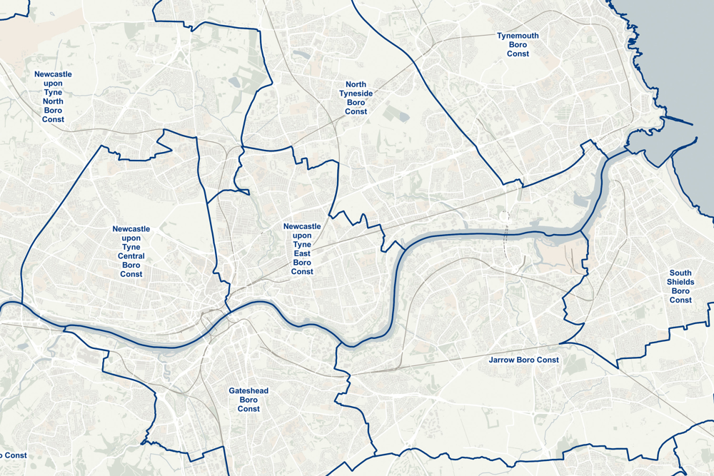
Geolookups by David Kane
This is a repository of boundaries that I've put together, using data from the ONS geoportal.
The aim of this is to produce 3 GeoJSON files for each Local Authority, Combined Authority or Region. Each file shows the boundaries of either Lower Super Output Areas (LSOA), Middle Super Output Areas (MSOA) or Wards within that area. They're meant to help people who want to map data in a small area. They use a fairly high resolution so you can pick out detail in the areas.
If you want to combile GeoJSON files together into one file, you can use my GeoJSON Merge Tool.
Other Resources
- Draw your own geography - A nice site that allows you to download a set of output areas based on either drawing on the map or choosing an existing area.
- UK local Authorities with insets - a readymade UK map with insets of urban areas. It's worth looking at the rest of the resources on that page - Alasdair Rae's resources are very useful.
- Local authority GIS data - a set of useful GIS data for Local Authorities in Great Britain. Includes boundaries but also includes roads, surface water, buildings, greenspace, etc - everything you need for making a map. More useful resources from Alasdair.
- Flourish - this is a great tool for making lots of different types of visualisations, and their mapping visualisation has lots of UK boundaries already available. You can also upload GeoJSON files from other sources.
- MapIt by MySociety and Find that Postcode by me both allow you to lookup and individual area's GeoJSON boundary and access it through an API.
- Open Innovations maintain a collection of GeoJSON files for different areas. (Thanks to Stuart from OI on mastodon.social for the suggestion).
What's missing?
I'd love to hear from you if there are other resources you find useful - I'm sure to have missed some! I'm particularly conscious that lots of the resources cover only either England and Wales or Great Britain, and are harder to find for Northern Ireland.
-
The site wasn't working at all when I wrote this blog post! ↩
